International Conference on Engineering Education and Research
”Progress Through Partnership”
Olomouc and Bouzov Castle, Czech Republic
June 27-30, 2004
|
|
iCEER 2004
International Conference on Engineering Education and Research ”Progress Through Partnership” Olomouc and Bouzov Castle, Czech Republic June 27-30, 2004 |
|
The Czech Republic is situated approximately in the geographical centre of Europe and has an area of 78,866 sq. km. It is a landlocked country 326 km away from the Baltic see and 322 km away from the Adriatic. It shares borders with Germany (810 km), Poland (762 km), Austria (466 km) and Slovakia (265 km). The highest point of elevation is the peak of Mt. Snezka (1,602 m above sea level) and the lowest point of elevation is near Hrensko where the River Labe leaves the Czech territory (117 m above sea level).
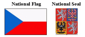
The three original lands of the Czech Crown are represented on the national seal by three crests:
a lion with two tails representing Bohemia, a red-and-white chequered eagle representing Moravia and a black eagle bearing a silver crescent representing Silesia.
National Anthem: Kde domov můj (Where is my Home)
Area: 78,886 sq.km
Capital: Prague (Praha) (Population: 1 213,800)
Length of state border: 2,303 km
Population: 10 304,302
Population density: 131 inhabitants/sq. km
Time zone: Central European Time (C.E.T.)
Political system: Parliamentary democracy
Currency: Koruna (Kc) - Czech crown (CZK)
1 USD = 26,28 CZK, March 3, 2004
1 EUR = 32,02 CZK, March 3,2004
Voltage: The line voltage for electricity is 230V 50Hz
Weather: In June, at the time of conference, the temperature usually ranges from 20 degrees of Celsius to 25 degrees of Celsius